POLYNESIAN VOYAGERS; THE FIRST PACIFIC VOYAGERS
HOME
THE STORY OF HAWAII
Story of Hawaii Videos
Hawaiian History Moment
ROAD TO PEARL HARBOR
ONLINE MUSEUM GIFT SHOP
Attack Photos
California
Captain Cook
Colton Maps
Maps
NOAA Nautical Charts
Nostalgia Prints and Posters
Sanborn Insurance Maps
Story of Hawaii
Theresa Crowley Spitler
WWII
ABOUT US
Newsletter
Press Room
Ongoing Events
Custom Group Presentation
CONTACT US
0 Items
1797 TAHITI SOCIETY ISLANDS CAPTAIN COOK – ORIGINAL ANTIQUE
$
1,500.00
1 in stock
1797 TAHITI SOCIETY ISLANDS CAPTAIN COOK - ORIGINAL ANTIQUE quantity
Add to cart
Additional information
Related products
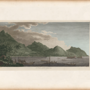
A VIEW OF HUAHINE
$
25.00
–
$
185.00
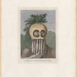
MAN IN A MASK
$
25.00
–
$
75.00
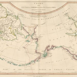
1784 Cook North Pacific Map
$
25.00
–
$
185.00
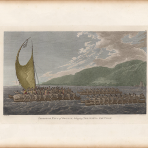
TERREBOO BRINGING GIFTS
$
25.00
–
$
185.00