
Description
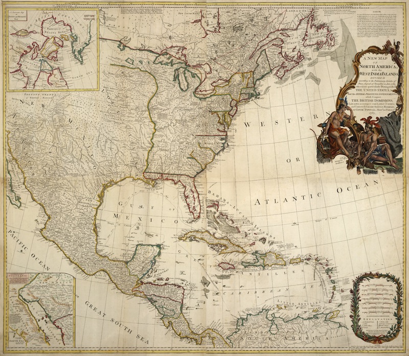
A new map of North America with the West India Islands.
divided according to the preliminary articles of peace, signed at Versailles 20 April 1783 wherein are particularly distinguished the Unites States of America, and the several provinces, goverments etc which compose the British Dominions.
A fascinating large scale four-sheet map of North America, extending southward to the West Indies and Central America. The scale of the map allows for detailed and accurate information and to display the very latest discoveries, such as the Jesuit priest Father Kino’s inset map of the land passage to the Pacific via California. A superbly decorative title cartouche features Native Americans in the upper right corner of the map, whilst an inset map of Baffin’s Bay and Hudson’s Bay is found in the upper left corner. This is a significant and visually stunning map of North America, published at the end of the War of Independence. There is minor offsetting, which is consistent with a map of this size. Published by Robert Sayer.